A large detailed map of Arizona State
This is a large, detailed map of Arizona. There are links to many Arizona localities below. Our website format reduces the display size for uniformity. Here is a link to the full-size image that is more easily readable.
View our Arizona State county map
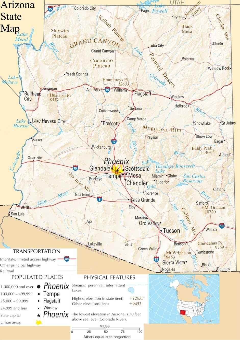
from the National Atlas of the United States
United States Department of the Interior
Arizona State Map
Explore Arizona with an interactive map featuring Street View, satellite and terrain views. Live weather, local news and location details for Arizona — plus links to detailed street maps for 536 cities and towns across the state.
Map search is available for a limited number of queries per session to manage costs. Be specific — search precisely for best results.
| State | Arizona (AZ) |
| Capital | Phoenix |
| Largest City | Phoenix |
| Country | United States |
| Latitude | 33.729759 |
| Longitude | -111.431221 |
| Population | 7,151,502 |
| Cities & Towns | 536 |
Arizona defines itself through a verticality that defies the flat expectations of the horizon. The Colorado River acts as a persistent sculptor, carving the landscape into immense, layered chasms that expose the geological memory of the earth in shades of ochre, violet, and rusted iron. To the north, the high-altitude forests of the Mogollon Rim offer a cool, pine-scented reprieve from the blistering intensity of the lower deserts, where the ground holds the day’s heat long after the sun has retreated. In these arid basins, the air often shimmers with a liquid clarity at dusk, turning the saguaros into dark, sentinel silhouettes against a sky that bruises into deep indigo. The geography is a study in extremes, shifting from the stark, volcanic fields of the plateaus to the sprawling, scrub-covered valleys where the light seems to possess a weight and presence all its own.
Ancestral Indigenous nations have occupied these canyons and river valleys for millennia, establishing complex societies long before Spanish explorers arrived in search of mythical riches. The arrival of European missions brought a new architectural language of adobe and stone to the southern borderlands, creating a cultural layering that persists in the quiet courtyards and irrigation canals still in use today. Arizona transitioned through a turbulent territorial era defined by mining booms and the expansion of the transcontinental railroads, eventually achieving statehood in the early twentieth century. This history is not a static relic but a living tension, visible in the way modern roads follow the ancient footpaths of the Hopi and Navajo people, bridging the gap between the nomadic past and the settled present.
Economic life in Arizona has evolved from the extraction of copper and the labor of cattle ranching into a diverse engine of technological manufacturing, aerospace engineering, and large-scale agricultural production. The massive irrigation projects of the past turned desert basins into productive fields of cotton and citrus, allowing life to flourish in an environment that naturally resists such abundance. While the industry of the state has shifted toward the digital and the global, the rhythm of the economy remains tied to the management of water and the harnessing of solar energy. This pursuit of productivity in a challenging climate requires a pragmatic, industrious spirit, where the ability to innovate becomes a necessary condition for survival in a land that demands constant adaptation from its inhabitants.
Cultural expression in the state is a synthesis of diverse influences, manifesting in a culinary landscape where green chile and flour tortillas are as essential as the sourdough of the frontier. The pace of life is dictated by the seasons, slowing during the intense heat of midsummer and accelerating when the monsoon clouds gather, bringing the sharp, metallic scent of ozone and wet earth to the dry streets. Sports hold a significant place in the public consciousness, with fervent support for collegiate programs and professional leagues serving as a communal anchor. Literature and art from the region often grapple with the vast, mile-deep silences of the wilderness, attempting to translate the stark majesty of the terrain into words and images. Whether in the quiet concentration of a neighborhood street or the collective energy of a stadium, Arizona maintains a distinct, deliberate character that feels both expansive and deeply rooted in the dust and light of its own territory.
Arizona City and Town Maps
A
B
C
D
E
F
G
H
J
K
L
M
N
O
P
R
S
T
V
W
Arizona Maps — Interactive Map, Street View, Weather & News
This page provides an interactive Google map of Arizona (AZ) with Street View, satellite and terrain views, alongside links to detailed street maps for 536 cities and towns across the state. The state capital is Phoenix and the largest city is Phoenix, with a state population of approximately 7,151,502.
Each city and town map page includes an embedded street and satellite map. Live weather where available combines National Weather Service forecasts with Open-Meteo graphical data including hourly and 7-day outlooks. Local and world news, Wikipedia location summaries, and precise GPS coordinates are included where available.
Location data is sourced from the USGS GNIS database and verified by coordinates, not name matching alone.
