A large detailed map of Kentucky State Counties
Explore Kentucky with an interactive map featuring Street View, satellite and terrain views. Browse all 120 counties of Kentucky below, with links to every city and town map page. Live weather and local news are included on every location page.
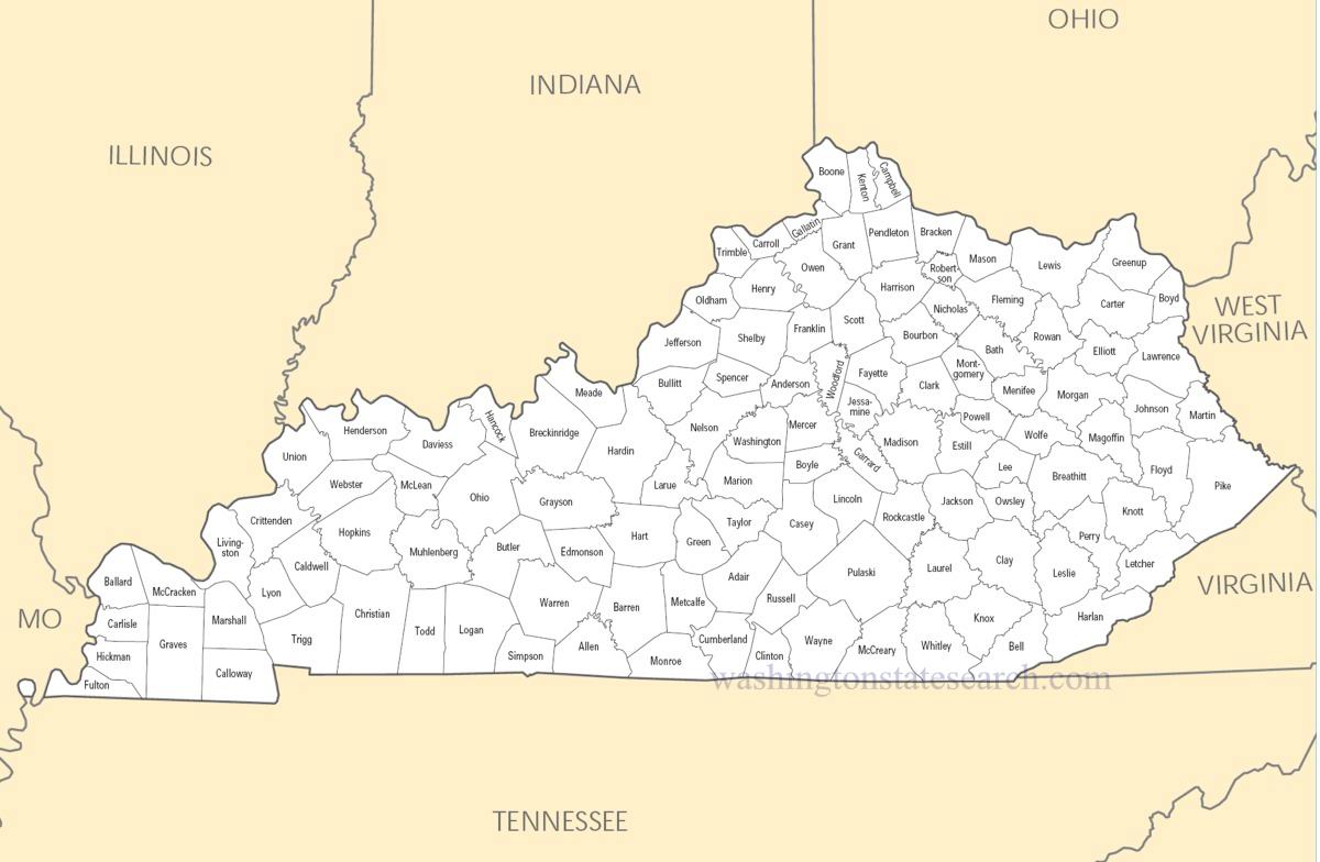
from the National Atlas of the United States
United States Department of the Interior
Kentucky State Map
Map search is available for a limited number of queries per session to manage costs. Be specific — search precisely for best results.
| State | Kentucky |
| Capital | Frankfort |
| Country | United States of America |
| Counties | 120 |
| Latitude | 37.66814 |
| Longitude | -84.670067 |
| Cities & Towns | 509 |
| State Map | Kentucky Maps |
About Kentucky
Kentucky divides itself into a series of distinct geological gestures, ranging from the jagged, coal-rich folds of the Cumberland Plateau in the east to the flat, fertile plains of the west. Beneath the surface, the state rests upon a vast foundation of limestone that filters the groundwater, creating the mineral-rich springs essential to the development of its signature spirits and the strength of its livestock. The Ohio River serves as a northern boundary, a wide, moving ribbon that has long dictated the flow of trade and travel, while the interior is characterized by the karst topography of the Pennyroyal and the sudden, vivid green of the central bluegrass basin. At dusk, the light here takes on a particular thickness, catching the dust of the fields and turning the horizon into a muted, bruised purple that feels older than the ground itself.
Indigenous nations such as the Shawnee, Cherokee, and Osage long utilized these lands as a hunting ground, moving through the dense hardwood forests and along the salt licks before colonial expansion pushed inward from the Atlantic coast. Kentucky became the fifteenth state in the union, serving as a gateway for settlers who navigated the Cumberland Gap to establish a life on the frontier. This transition was marked by violent friction and the slow, arduous clearing of timber to make room for homesteads. The legacy of that era remains visible in the way the local architecture clings to the landscape, with stone foundations and heavy timber frames that seem to have grown out of the earth rather than being placed upon it, reflecting a history of endurance forged in the isolation of the mountains and the promise of the river valleys.
Agriculture and industry have long defined the daily labor of the citizenry, moving from the early dominance of hemp and tobacco to the sophisticated production of thoroughbreds and distilled spirits. The land requires a specific kind of devotion; the soil of the central basin provides the calcium necessary for the skeletal development of racehorses, making the region a global center for equine excellence. In the eastern reaches, the extraction of coal once fueled the industrial expansion of the nation, leaving behind a complex legacy of economic dependency and communal resilience. Today, the economy balances these traditional exports with modern manufacturing and logistics, yet the scent of charred oak barrels and freshly turned hay remains the primary sensory signature of the workforce, grounding the state in a cycle of production that is tied directly to the seasons.
Cultural identity in Kentucky is articulated through a deliberate, soft-spoken vernacular that carries the weight of a long memory. The pace of life is marked by the collegiate sport seasons, which function almost like a secular liturgy, drawing communities together in a shared obsession that transcends local boundaries. Music, deeply rooted in the ballad traditions of the Appalachians, continues to evolve in the small gathering spaces and porches where the fiddle and banjo dictate the tempo of the evening. This is a place that values the telling of a story, where the kitchen table serves as the primary theater for passing down history and opinion. Even in the modern noise, one can find a quiet intensity in the way a person describes their neighbor or the weather, a testament to a culture that prefers the slow, careful observation of the world over the frantic speed of the outside.
Kentucky Cities and Towns by County
Boone County
Campbell County
Daviess County
Graves County
Harlan County
Hopkins County
Jefferson County
Kenton County
Pike County
Kentucky County Maps & Location Information
This page provides an interactive Google map of Kentucky (KY) with Street View, satellite and terrain views, alongside links to detailed street maps for all 509 cities and towns across the state organised by county. Kentucky has 120 counties, with the state capital at Frankfort.
Every locality page includes an embedded street and satellite map alongside live weather where available — combining National Weather Service forecasts with Open-Meteo graphical data including hourly observations and 7-day outlooks. Local and world news feeds, Wikipedia summaries and editorially written descriptions are included where available.
Location data is sourced from the USGS GNIS database and the SimpleMaps US Cities dataset, verified by coordinates rather than name matching alone.
