United States Map
Explore the United States with an interactive map featuring Street View, satellite and terrain views. Our location pages across all 50 states, D.C. and US territories are real-time information hubs — built for travel planning, research and emergencies, including storms, flooding and severe weather events.
Interactive Map of the United States
Map search is available for a limited number of queries per session to manage costs. Be specific — search precisely for best results.
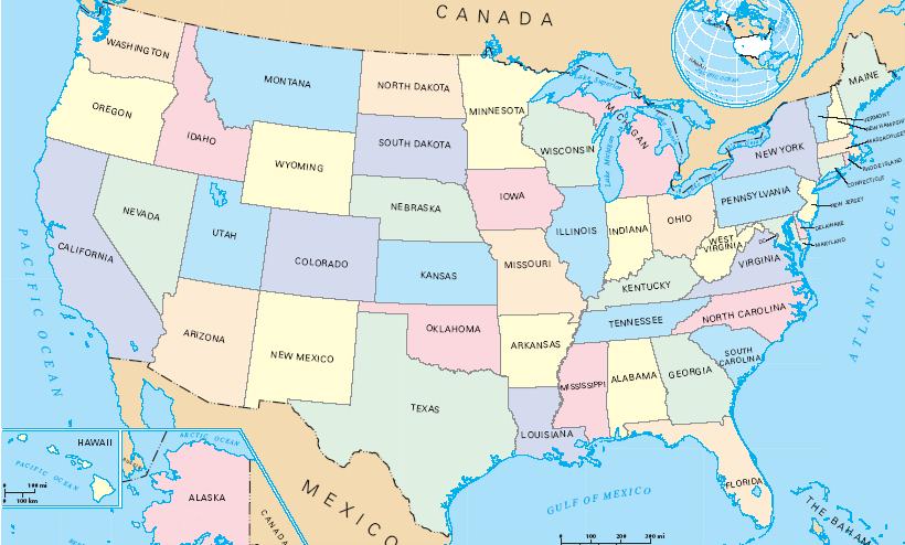
Map of the United States of America
Below is a static reference map of the United States of America showing all 50 states.
State Maps
County Maps
Special Maps
| Country | United States of America |
| Capital | Washington, D.C. |
| Largest City | New York City |
| States | 50 states + D.C. + territories |
| Timezone | Multiple (UTC−4 to UTC−12) |
| Latitude | 39.8283 |
| Longitude | -98.5795 |
| Population | 331,449,281 |
| Area | 9,833,517 km² |
| Currency | US Dollar (USD) |
About the United States
United States’ vast expanse unfolds from the salt-laced air of the Atlantic to the dramatic Pacific shores, a continent sculpted by immense natural forces. The ancient, rolling peaks of the Appalachians give way westward to the formidable ramparts of the Rocky Mountains, their snow-capped summits a stark contrast to the endless, golden seas of the Great Plains. Further south, the sun-baked landscapes of the Southwest shimmer with desert hues, while the colossal freshwater arteries of the Great Lakes and the mighty Mississippi River system drain the heartland. This immense geography dictates a spectrum of climates, from the frozen tundras of Alaska to the balmy, tropical embrace of the Florida Keys and the volcanic islands of Hawaii, presenting a kaleidoscope of natural beauty across the United States.
The story of the United States is woven from threads of ancient heritage and continuous transformation, beginning with the deep roots of Indigenous peoples who thrived across these lands for millennia. European exploration and settlement then introduced new languages, traditions, and a desire for self-governance, culminating in the bold declaration of independence and the formation of a republic. A relentless spirit of westward expansion, often fraught with conflict and displacement, shaped the nation's physical and cultural boundaries, eventually leading to the profound schism of the Civil War and the arduous process of Reconstruction. The subsequent surge of industrialization and waves of immigration from around the globe have forged the United States into a dynamic, predominantly urban society, perpetually redefining itself.
Governing this sprawling nation is a complex federal system, comprising fifty states and the District of Columbia, all united under a foundational Constitution and a Bill of Rights designed to safeguard individual liberties. Power is meticulously divided among three distinct branches: the legislative, executive, and judicial, each serving as a check and balance on the others. This structure, while robust, also necessitates a constant negotiation of responsibilities between the federal government and individual states, a dynamic that shapes policy and daily life. As a prominent global player, the United States actively participates in international organizations, holding founding membership in the United Nations, NATO, and the World Trade Organization, reflecting its significant role on the world stage.
The economic engine of the United States is the largest in the world by nominal GDP, a testament to its innovation and diverse industrial landscape. Technological marvels emerge from the sun-drenched campuses of Silicon Valley, while the financial heart of the nation beats within the towering skyscrapers of New York City. The energy sector thrives in Texas and along the Gulf Coast, fueling industries and homes across the land. Vast swathes of the Midwest are dedicated to agriculture, feeding both domestic and international markets, while the aerospace industry reaches for the skies. Entertainment finds its epicenter in Los Angeles, and the allure of tourism draws millions to its natural wonders and vibrant cities, showcasing a dynamic economy increasingly driven by services.
The cultural tapestry of the United States is as rich and varied as its geography, vibrantly expressed through its passion for sports and a diverse array of artistic endeavors. The roar of the crowd accompanies the high-stakes games of the NFL, NBA, MLB, and NHL, while the fervor for college football and basketball ignites communities nationwide. The nation's musical heritage is a global phenomenon, spanning the soulful depths of jazz and blues, the heartfelt narratives of country music, the rhythmic pulse of hip-hop, and the electrifying energy of rock and roll. Hollywood's cinematic magic captivates audiences, and regional culinary traditions, from smoky barbecue to zesty Tex-Mex and the fresh seafood of New England, define the distinct flavors of daily life across the United States.
Latest News: United States
Loading news…
World News
Loading world news…
Explore the USA — Interactive Map, Street View, Weather & News
This page provides an interactive Google map of the United States with Street View, satellite and terrain views. Each of our 46,754+ US location map pages is a self-contained information hub updated in real time. Precise GPS coordinates are included on every page.
Where available, pages display live weather from the National Weather Service alongside a graphical forecast from Open-Meteo, including current conditions, an hourly outlook and a 7-day forecast. Local and world news is sourced from multiple feeds and updated continuously.
Location-specific information — including county, state, timezone, population, elevation and ZIP code — is drawn from the USGS GNIS database and the SimpleMaps US Cities dataset. Wikipedia summaries are included where a verified match exists.
Location data is verified by coordinates, not name matching alone.
| Page generated | July 2026 |
| Location data | US Geographic Center, Geographic Names Information System (GNIS) |