A large detailed map of Maine State
This is a large, detailed map of Maine. There are links to many Maine localities below. Our website format reduces the display size for uniformity. Here is a link to the full-size image that is more easily readable.
View our Maine State county map
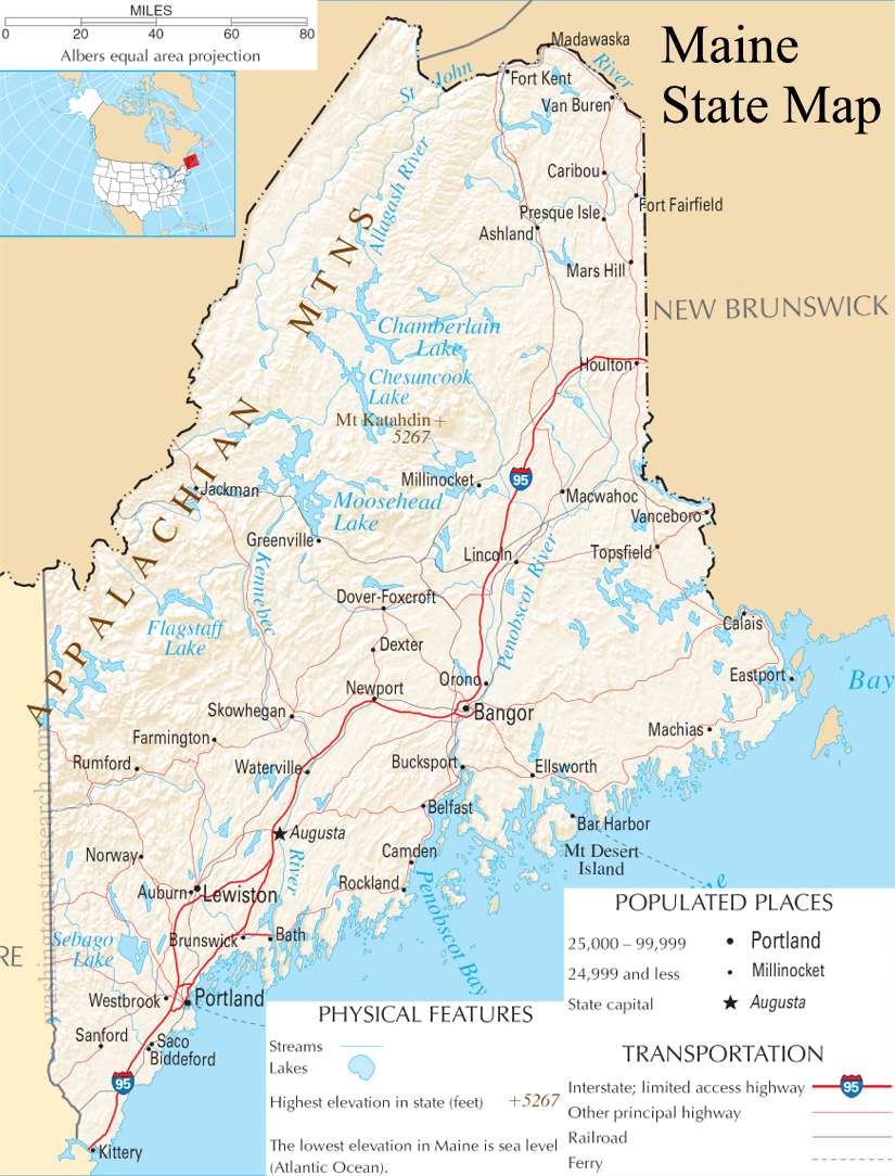
from the National Atlas of the United States
United States Department of the Interior
Maine State Map
Explore Maine with an interactive map featuring Street View, satellite and terrain views. Live weather, local news and location details for Maine — plus links to detailed street maps for 155 cities and towns across the state.
Map search is available for a limited number of queries per session to manage costs. Be specific — search precisely for best results.
| State | Maine (ME) |
| Capital | Augusta |
| Largest City | Portland |
| Country | United States |
| Latitude | 44.693947 |
| Longitude | -69.381927 |
| Population | 1,362,359 |
| Cities & Towns | 155 |
Maine occupies the northeastern extremity of the country, a vast wilderness where the spruce-fir forests of the north dominate the interior, stretching toward the Canadian border in a dense, dark tangle of needles and shadowed loam. The landscape is defined by the heavy, glacially-scoured granite of its coastline, which breaks the Atlantic into thousands of jagged peninsulas and islands. Great river systems like the Penobscot and the Kennebec pulse through the center of the state, carving paths through the rolling Appalachian foothills and feeding the salt marshes that line the shore. At dusk, the light here loses its sharpness, turning a bruised, metallic gray that seems to pull the heat out of the granite ledges, leaving the air brittle and smelling of cold brine and resin.
Indigenous nations, including the Penobscot, Passamaquoddy, Maliseet, and Mi’kmaq, have held this territory for millennia, their presence defined by an intimate knowledge of the interior waterways and the seasonal migration of fish. European contact brought a slow, grinding friction, as fishing outposts and trading missions gradually solidified into permanent colonial settlements. After a long period of administrative attachment to Massachusetts, Maine gained its own statehood in the early nineteenth century, a political separation that allowed the region to cultivate a distinct identity rooted in its isolation. The history of the land is preserved in the weathered wood of old meeting houses and the stubborn, independent spirit of families who have farmed the same rocky soil for generations, their lives governed by the harsh necessity of surviving winters that feel longer than the calendar suggests.
Economic life in Maine has always been tied to the extraction of what the land and sea provide, shifting from the massive timber harvests that once fueled the nation’s construction to the current dependence on the cold-water harvest. The coastal economy remains anchored by the lobster pot and the trawler, while inland, the vast blueberry barrens turn a brilliant, fiery red in the autumn, a stark contrast to the white-washed buildings of the small villages. Manufacturing has transitioned from large-scale paper mills to smaller, specialized enterprises, yet the state remains defined by the labor of its people, who often balance multiple seasonal trades to make ends meet. There is a specific, quiet industry in the way a gear is mended or a boat is hauled for the winter, a pragmatic focus that ignores the fleeting trends of the outside world in favor of reliability and long-term maintenance.
Cultural character in Maine is expressed through a reserved, dry humor and a preference for the local over the imported, a state of mind shaped by the long, low-hanging light of the Atlantic winter. Literature and music here often lean into the eerie silence of the deep woods or the claustrophobia of a snowbound village, reflecting a landscape that can feel both protective and indifferent to human concerns. Collegiate sports provide a rare, communal outlet for a population otherwise spread thin across the expansive interior, though the real rhythm of life is found in the daily errands—the check at the general store, the conversation at the post office, the careful navigation of ice-slicked roads. It is a place where the people possess a grounded, unsentimental grace, moving through the seasons with a quiet focus that recognizes how quickly the frost can settle and how deeply the tides can pull.
Maine City and Town Maps
B
C
D
F
G
K
L
M
N
P
S
W
Maine Maps — Interactive Map, Street View, Weather & News
This page provides an interactive Google map of Maine (ME) with Street View, satellite and terrain views, alongside links to detailed street maps for 155 cities and towns across the state. The state capital is Augusta and the largest city is Portland, with a state population of approximately 1,362,359.
Each city and town map page includes an embedded street and satellite map. Live weather where available combines National Weather Service forecasts with Open-Meteo graphical data including hourly and 7-day outlooks. Local and world news, Wikipedia location summaries, and precise GPS coordinates are included where available.
Location data is sourced from the USGS GNIS database and verified by coordinates, not name matching alone.
