A large detailed map of South Dakota State Counties
Explore South Dakota with an interactive map featuring Street View, satellite and terrain views. Browse all 66 counties of South Dakota below, with links to every city and town map page. Live weather and local news are included on every location page.
View our South Dakota State map
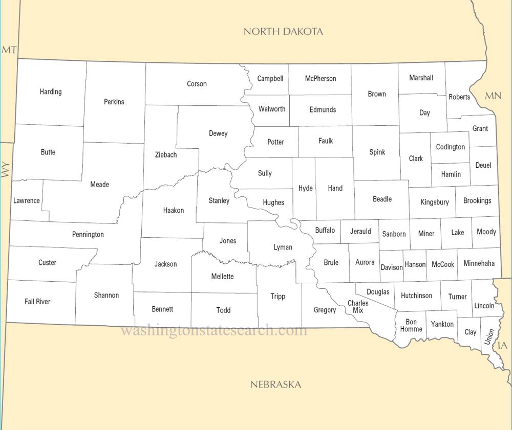
from the National Atlas of the United States
United States Department of the Interior
South Dakota State Map
Map search is available for a limited number of queries per session to manage costs. Be specific — search precisely for best results.
| State | South Dakota |
| Capital | Pierre |
| Country | United States of America |
| Counties | 66 |
| Latitude | 44.299782 |
| Longitude | -99.438828 |
| Cities & Towns | 480 |
| State Map | South Dakota Maps |
About South Dakota
South Dakota divides itself into two distinct realms, severed by the wide, sediment-heavy ribbon of the Missouri River. To the east, the land is a vast, disciplined geometry of glacial till and flat horizons, where the prairie yields to the heavy machinery of modern cultivation. Westward, the terrain shatters into the jagged, rusted spires of the Badlands and the dense, pine-darkened rise of the Black Hills. Here, the air thins and sharpens, carrying a scent of dry needles and cooling granite. At dusk, the light in the western reaches loses its midday glare, turning the sandstone formations into a bruised, shifting violet that seems to hold the heat of the day long after the sun has vanished behind the mountain rim.
Indigenous nations—the Oceti Sakowin—have long held these plains as a central geography of their existence, and the weight of that stewardship remains palpable in the silence of the high mesas. European arrival arrived in waves of fur traders and gold seekers, each group leaving scars that have never fully faded from the collective memory. Statehood arrived in the late nineteenth century as a formalization of an uneasy frontier, tethering a sprawling, untamable territory to the federal map. The history of South Dakota is marked by the sharp collision of cultures, a narrative defined by treaty lines drawn in ink and then broken by the relentless, grinding pressure of westward expansion that sought to claim the earth for fences and rails.
Agriculture remains the primary pulse of the economy, a quiet, repetitive labor that dictates the state’s seasonal clock. Farmers and ranchers manage vast tracts of corn, soy, and wheat, while cattle graze the shortgrass prairies with a slow, deliberate persistence. In the industrial pockets, manufacturing and financial services have emerged to supplement the traditional reliance on the soil, yet the state’s identity remains tethered to the production of raw commodities. There is a particular, austere beauty in the sight of a combine harvester moving through a field under a vast, cloud-streaked sky, the machine’s yellow frame a stark contrast to the muted ochre of the ripening grain, signaling a cycle of planting and harvest that has sustained the local populace for generations.
Cultural life in South Dakota moves at the pace of a long-distance traveler, favoring a reserved pragmatism over the frantic energy of coastal centers. Collegiate athletics serve as the primary communal focus, drawing thousands to stadiums where the wind often dictates the flight of a football as much as the players do. The culinary landscape is dominated by simple, sturdy fare—wild game, local beef, and the ubiquitous fry bread that serves as a quiet reminder of the state’s complex heritage. Music and literature here often reflect the isolation of the landscape, favoring a folk-inflected storytelling that acknowledges the immense scale of the sky. In the small neighborhood cafes and quiet town squares, conversation is sparse and careful, a reflection of a people who have learned that words, like rain in the high plains, are best used sparingly and with intention.
South Dakota Cities and Towns by County
Beadle County
Brookings County
Charles Mix County
Clark County
Dewey County
Fall River County
Faulk County
Hamlin County
Hutchinson County
Kingsbury County
Lake County
Lawrence County
Marshall County
Minnehaha County
Pennington County
Roberts County
Spink County
Todd County
Turner County
South Dakota County Maps & Location Information
This page provides an interactive Google map of South Dakota (SD) with Street View, satellite and terrain views, alongside links to detailed street maps for all 480 cities and towns across the state organised by county. South Dakota has 66 counties, with the state capital at Pierre.
Every locality page includes an embedded street and satellite map alongside live weather where available — combining National Weather Service forecasts with Open-Meteo graphical data including hourly observations and 7-day outlooks. Local and world news feeds, Wikipedia summaries and editorially written descriptions are included where available.
Location data is sourced from the USGS GNIS database and the SimpleMaps US Cities dataset, verified by coordinates rather than name matching alone.
