A large detailed map of Ohio State
This is a large, detailed map of Ohio. There are links to many Ohio localities below. Our website format reduces the display size for uniformity. Here is a link to the full-size image that is more easily readable.
View our Ohio State county map
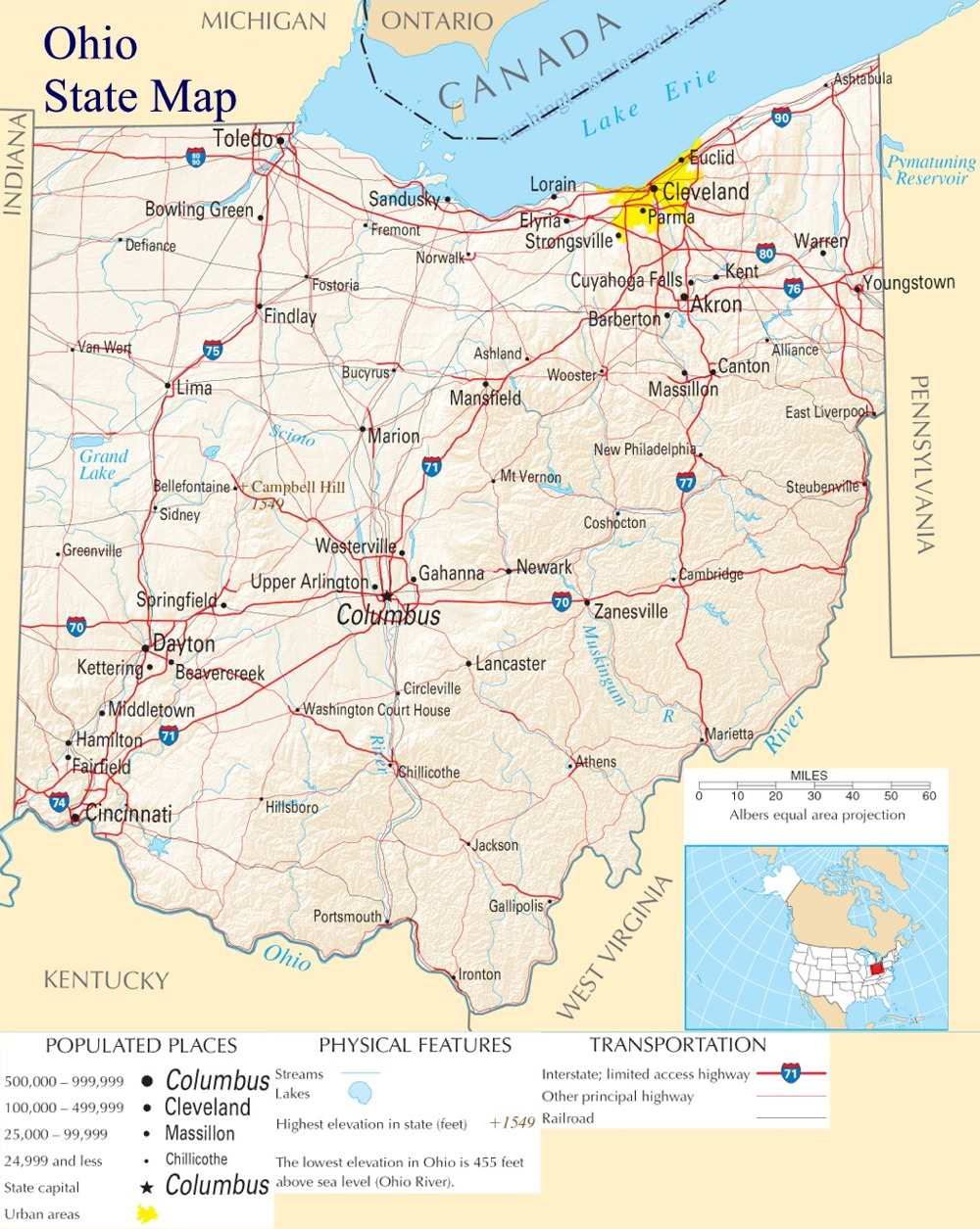
from the National Atlas of the United States
United States Department of the Interior
Ohio State Map
Explore Ohio with an interactive map featuring Street View, satellite and terrain views. Live weather, local news and location details for Ohio — plus links to detailed street maps for 1,287 cities and towns across the state.
Map search is available for a limited number of queries per session to manage costs. Be specific — search precisely for best results.
| State | Ohio (OH) |
| Capital | Columbus |
| Largest City | Columbus |
| Country | United States |
| Latitude | 40.388783 |
| Longitude | -82.764915 |
| Population | 11,799,448 |
| Cities & Towns | 1,287 |
Ohio stretches across a landscape defined by the tension between the flat, glacial plains of the north and the jagged, ancient spine of the Appalachian foothills in the southeast. To the north, the shore of Lake Erie acts as a vast, inland sea, where the light at dusk turns the water into a sheet of hammered pewter, reflecting the long, industrial silhouettes of harbors that once fueled the nation’s expansion. The state is bisected by the Ohio River, a wide and deliberate current that serves as both a physical boundary and a historic gateway, carving through limestone and shale. In the east, the terrain fractures into deep, wooded ravines and sudden, steep ridges, while the western expanses remain open and expansive, holding the cold, heavy air of the plains until the sun warms the dark, rich soil of the river valleys.
Indigenous nations, including the Shawnee, Miami, and Delaware, maintained complex societies along these river corridors long before the arrival of European surveyors and soldiers. Following the conflicts of the late eighteenth century, the region became the first territory organized under the Northwest Ordinance, a formal beginning that established the patterns of grid-based townships that still dictate the movement of traffic and property lines today. The arrival of settlers from New England brought a distinct architecture of white-steepled churches and village greens to the north, while migrants from Virginia and Pennsylvania pushed into the southern valleys, bringing different customs and dialects. Ohio entered the Union as a strategic frontier, eventually becoming a critical theater for the abolitionist movement, its waterways serving as clandestine passages for those seeking freedom in the north.
Industry and agriculture have long operated in a delicate, often strained, partnership across the Ohio landscape. In the north, the legacy of steel mills and rubber production remains visible in the skeletal remains of iron works and the active, high-tech corridors that have risen in their wake, turning raw materials into the machinery of global trade. Meanwhile, the eastern reaches are marked by the quiet, disciplined labor of agrarian communities who work the land with a focus on traditional methods, their fields offering a stark contrast to the automated output of the suburban manufacturing plants. This dual identity—a place that builds and a place that grows—creates a unique economic friction, where the smell of oil and coal smoke occasionally mingles with the scent of drying hay, defining the state’s long-standing role as a primary engine for American production.
Cultural life in Ohio manifests as a layered, sometimes contradictory, mosaic of local loyalties and intellectual pursuits. On autumn Saturdays, the atmosphere in major collegiate centers becomes electric, a singular focus that overrides the mundane concerns of the work week, while in the quieter corners, the influence of figures like James Thurber and Toni Morrison persists in the way people observe their own neighborhoods—with a sharp, unsparing wit and a deep sensitivity to the weight of the past. The state’s culinary landscape is equally varied, ranging from the distinct, spiced traditions brought by Mediterranean and Eastern European immigrants to the hearty, unpretentious meals favored in rural diners. Life here moves at a pace that demands a certain level of patience; it is a place where the weather can turn from a humid, heavy stillness to a sharp, biting wind in a matter of hours, and the people have learned to mirror that temperament, favoring a direct, grounded approach to the daily grind of existence.
Ohio City and Town Maps
A
B
C
D
E
F
G
H
J
K
L
M
N
O
P
R
S
T
U
V
W
Z
Ohio Maps — Interactive Map, Street View, Weather & News
This page provides an interactive Google map of Ohio (OH) with Street View, satellite and terrain views, alongside links to detailed street maps for 1,287 cities and towns across the state. The state capital is Columbus and the largest city is Columbus, with a state population of approximately 11,799,448.
Each city and town map page includes an embedded street and satellite map. Live weather where available combines National Weather Service forecasts with Open-Meteo graphical data including hourly and 7-day outlooks. Local and world news, Wikipedia location summaries, and precise GPS coordinates are included where available.
Location data is sourced from the USGS GNIS database and verified by coordinates, not name matching alone.
