A large detailed map of Pennsylvania State
This is a large, detailed map of Pennsylvania. There are links to many Pennsylvania localities below. Our website format reduces the display size for uniformity. Here is a link to the full-size image that is more easily readable.
View our Pennsylvania State county map
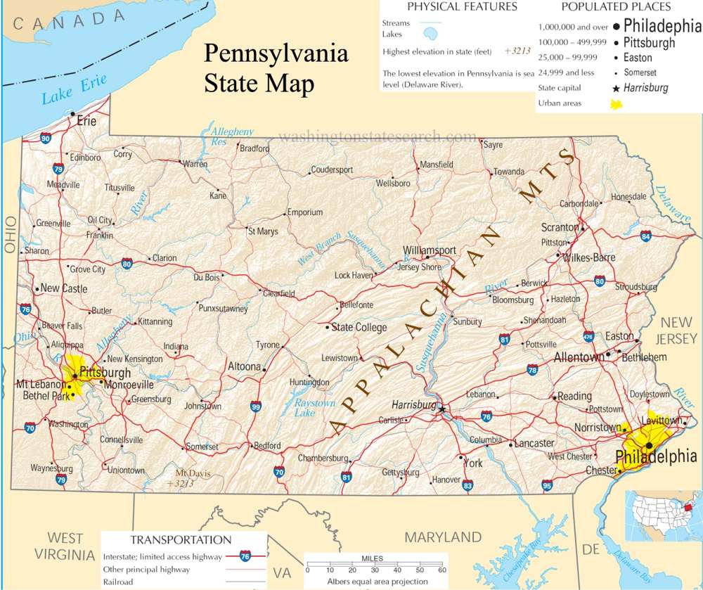
from the National Atlas of the United States
United States Department of the Interior
Pennsylvania State Map
Explore Pennsylvania with an interactive map featuring Street View, satellite and terrain views. Live weather, local news and location details for Pennsylvania — plus links to detailed street maps for 2,237 cities and towns across the state.
Map search is available for a limited number of queries per session to manage costs. Be specific — search precisely for best results.
| State | Pennsylvania (PA) |
| Capital | Harrisburg |
| Largest City | Philadelphia |
| Country | United States |
| Latitude | 40.590752 |
| Longitude | -77.209755 |
| Population | 13,002,700 |
| Cities & Towns | 2,237 |
Pennsylvania occupies a rugged, tilting landscape that drops from the high, forested reaches of the Allegheny Plateau down into the folded, parallel spines of the ridge-and-valley system. The terrain is defined by the heavy, insistent flow of the three great river corridors that dictate the movement of water and people alike, carving deep channels through the gray shale and limestone bedrock. In the east, the land flattens toward the tidewater, where the air grows thick and heavy with the salt-tinged breath of the Atlantic, while the western reaches are defined by a jagged, broken topography of steep ravines and sudden, mist-heavy hollows. The light here in the late afternoon often turns a bruised, metallic violet, catching the silt-laden currents of the rivers as they churn toward the sea, reminding the observer that the earth is not a static thing, but a slow, persistent friction between water and stone.
Indigenous nations—the Lenape, the Susquehannock, and the Haudenosaunee—shaped the initial geography of human movement, tracing the ridgelines and water gaps long before the arrival of European ships. Pennsylvania became a crucible of colonial expansion, drawing diverse groups to its fertile limestone valleys and wooded frontiers under a promise of religious autonomy that was as radical as it was fragile. The settlement patterns that emerged were not uniform; they were layered, with stone-built farmsteads and meeting houses providing a firm, enduring foundation for a province that would eventually serve as the intellectual and political fulcrum of a new nation. The weight of these formative years remains palpable in the silence of an old field, where the rusted iron of a plow blade occasionally surfaces from the dark, upturned loam as if waiting to be claimed by the present.
Industry and agriculture define the state’s internal metabolism, shifting from the deep-earth labor of coal extraction in the northeast to the precise, seasonal geometry of dairy and produce farming in the central plains. Pennsylvania has long functioned as a forge for the nation, its identity once inextricably linked to the heat of coke ovens and the rhythmic, percussive roar of rolling mills that lined the riverbanks. While the great furnaces have largely cooled, the legacy of that production remains in the brick-lined neighborhoods and the resilient, work-hardened character of its people. The land itself is productive in a way that feels intentional; orchards in the south and fields of corn stretching toward the horizon are evidence of a culture that values the tangible output of one’s own hands, an ethic that persists even as the nature of labor migrates toward medicine, education, and technology.
Cultural life here is marked by a certain reticence, a preference for the local over the abstract, and a deep-seated loyalty to the traditions of the neighborhood. Sunday afternoons are measured by the cadence of collegiate and professional games, where the collective focus of a community narrows to the green expanse of a field or the hard wood of a court, creating a temporary, shared intensity that cuts through the routine of the work week. The food reflects the long history of migration, from the sturdy, unadorned staples of the rural interior to the complex, savory offerings of the urban centers, all consumed with a pragmatic lack of pretension. People move with a deliberate, steady pace that acknowledges the harshness of the winters and the humidity of the summers, carrying themselves with the quiet, unvarnished dignity of those who understand that life is best sustained by what is familiar, reliable, and close at hand.
Pennsylvania City and Town Maps
A
B
C
D
E
F
G
H
I
J
K
L
M
N
O
P
Q
R
S
T
U
V
W
Y
Z
Pennsylvania Maps — Interactive Map, Street View, Weather & News
This page provides an interactive Google map of Pennsylvania (PA) with Street View, satellite and terrain views, alongside links to detailed street maps for 2,237 cities and towns across the state. The state capital is Harrisburg and the largest city is Philadelphia, with a state population of approximately 13,002,700.
Each city and town map page includes an embedded street and satellite map. Live weather where available combines National Weather Service forecasts with Open-Meteo graphical data including hourly and 7-day outlooks. Local and world news, Wikipedia location summaries, and precise GPS coordinates are included where available.
Location data is sourced from the USGS GNIS database and verified by coordinates, not name matching alone.
