A large detailed map of Idaho State Counties
Explore Idaho with an interactive map featuring Street View, satellite and terrain views. Browse all 44 counties of Idaho below, with links to every city and town map page. Live weather and local news are included on every location page.
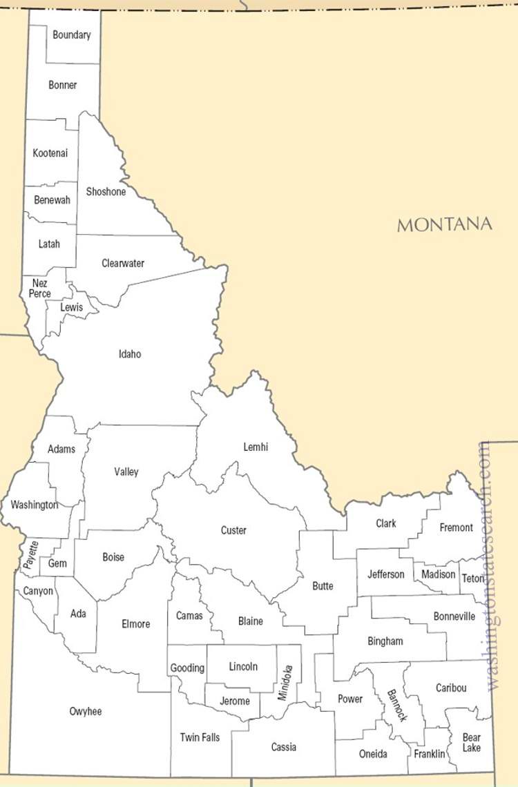
from the National Atlas of the United States
United States Department of the Interior
Idaho State Map
Map search is available for a limited number of queries per session to manage costs. Be specific — search precisely for best results.
| State | Idaho |
| Capital | Boise |
| Country | United States of America |
| Counties | 44 |
| Latitude | 44.240459 |
| Longitude | -114.478828 |
| Cities & Towns | 230 |
| State Map | Idaho Maps |
About Idaho
Idaho possesses a topography defined by violent geological upheaval and the patient persistence of water. The northern panhandle is a labyrinth of deep, glacial lakes and dense, coniferous forests, while the central expanse rises into the jagged, granite teeth of high mountain ranges that hold snow long into the summer months. To the south, the Snake River cuts a profound scar across the basalt plains, a landscape of porous volcanic rock where rivers occasionally vanish into the earth only to reappear miles later as freezing, crystalline springs. The light here is thin and piercing, stripped of humidity, which grants the distant horizon a startling clarity that makes the vast, arid sagebrush basins appear deceptively close to the cooling shadows of the high timber.
Indigenous nations, including the Shoshone, Bannock, and Nez Perce, navigated these complex corridors of mountain and canyon long before the arrival of outsiders. The nineteenth century brought an influx of fur trappers, missionaries, and those seeking the promise of precious metals, fundamentally altering the demographic landscape and sparking inevitable, tragic friction. Idaho attained statehood in the final decade of the nineteenth century, emerging from a period of territorial volatility that necessitated the establishment of rigid legal and social structures. The memory of these early frontiersmen remains visible in the hushed, wooden facades of older downtowns, where the architecture reflects a utilitarian necessity born of harsh winters and the isolation of the high desert.
Agriculture serves as the economic backbone of the state, though the nature of the harvest varies wildly across its diverse latitudes. The volcanic soil of the southern plains provides an ideal medium for the cultivation of potatoes, sugar beets, and barley, organized into vast, irrigated geometries that turn the desert green under the heat of July. Historically, the extraction of silver and lead from the northern mountains dictated the rise and fall of isolated labor communities, weaving a legacy of industrial grit into the state’s identity. Today, Idaho balances this traditional dependence on the land with a burgeoning technology sector and a refined manufacturing base, yet the rhythm of the economy still waits for the seasonal pulse of the harvest to determine its true speed.
Cultural life in Idaho is defined by a quiet, self-reliant independence that values the tangible over the abstract. Collegiate sports generate a fervor that transcends the regional, serving as a primary source of civic cohesion during the long, gray months of winter. The local palate remains unpretentious, favoring simple, hearty fare that respects the bounty of the surrounding fields and streams. Literature and music here often mirror the landscape, favoring themes of solitude and the quiet observation of a changing environment. As dusk falls, the air cools rapidly, carrying the sharp scent of dry grass and pine, and the people move with a deliberate, measured gait that suggests they are accustomed to living in a place where the scale of the world is always larger than the scale of the individual.
Idaho Cities and Towns by County
Kootenai County
Idaho County Maps & Location Information
This page provides an interactive Google map of Idaho (ID) with Street View, satellite and terrain views, alongside links to detailed street maps for all 230 cities and towns across the state organised by county. Idaho has 44 counties, with the state capital at Boise.
Every locality page includes an embedded street and satellite map alongside live weather where available — combining National Weather Service forecasts with Open-Meteo graphical data including hourly observations and 7-day outlooks. Local and world news feeds, Wikipedia summaries and editorially written descriptions are included where available.
Location data is sourced from the USGS GNIS database and the SimpleMaps US Cities dataset, verified by coordinates rather than name matching alone.
