A large detailed map of Mississippi State
This is a large, detailed map of Mississippi. There are links to many Mississippi localities below. Our website format reduces the display size for uniformity. Here is a link to the full-size image that is more easily readable.
View our Mississippi State county map
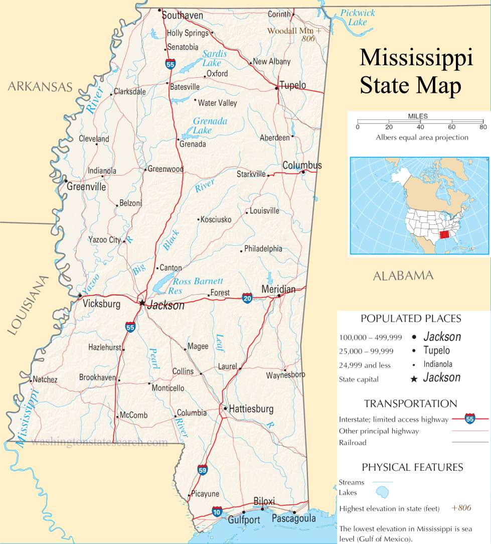
from the National Atlas of the United States
United States Department of the Interior
Mississippi State Map
Explore Mississippi with an interactive map featuring Street View, satellite and terrain views. Live weather, local news and location details for Mississippi — plus links to detailed street maps for 384 cities and towns across the state.
Map search is available for a limited number of queries per session to manage costs. Be specific — search precisely for best results.
| State | Mississippi (MS) |
| Capital | Jackson |
| Largest City | Jackson |
| Country | United States |
| Latitude | 32.741646 |
| Longitude | -89.678696 |
| Population | 2,961,279 |
| Cities & Towns | 384 |
Mississippi holds a geography defined by the slow, heavy movement of water and the persistent gravity of its alluvial plains. To the northwest, the Delta stretches out in a flat, shimmering expanse where the soil is dark enough to stain the hands, a basin created by the meandering of the great river that marks the state’s western boundary. Moving eastward, the terrain gathers itself into sudden rises and ridges, shifting from the silt-heavy bottomlands to the pine-studded uplands that catch the light in long, amber needles during the late afternoon. The southern edge of the state meets the Gulf, where the air grows thick with salt and humidity, and the coastline is defined by the shallow, quiet bays that pull back to reveal white sand under a wide, gray sky.
Indigenous nations—the Choctaw, Chickasaw, and Natchez—long walked these woods and riverbanks, shaping the landscape through seasonal movement and trade long before the first European outposts appeared. The arrival of French, Spanish, and British interests turned the riverfront into a contested corridor, eventually drawing the state into a plantation economy that relied upon the forced labor of enslaved people, a dark and permanent stain on its development. Following its admission to the Union in 1817, Mississippi became a primary theater for the conflicts that would define the American nineteenth century. The physical scars of that era remain, visible in the brick of river-town warehouses and the silent, columned silhouettes that stand as reminders of a social order that was violently dismantled and eventually forced to reckon with its own ghosts.
Agriculture remains the state’s pulse, though the nature of the work has shifted from the expansive cotton fields of the past to a more diverse landscape of catfish ponds, timber harvests, and poultry production. The heat of the growing season is a physical presence here, a weight that dictates the pace of labor and the cycle of the day. Modern industry has moved into the corridors between the fields, with aerospace manufacturing and shipbuilding now anchoring the coastal and urban economies. Yet, the land itself retains a stubborn memory; one can walk through a field and still find the remnants of old iron tools or the stubborn, invasive spread of kudzu reclaiming the edges of a highway, showing how easily the wild world reasserts itself when the machinery of the modern economy pauses.
Cultural expression in Mississippi often finds its voice in the spaces between the spoken word and the melody of a guitar. The blues emerged from the juke joints and porches of the Delta, a music that carries the same cadence as the slow, lyric sentences found in the state’s literature, where the storytelling is as dense and humid as the climate. Sundays are defined by the fervor of the collegiate football stadiums, where the collective attention of the state focuses on the ritual of the game, a stark contrast to the quiet, solitary work of the writer or the musician. Life here moves according to a distinct local gravity, where the porch light flickering on at dusk marks the end of a day, and the conversation is measured by a deliberate, patient rhythm that assumes there is always enough time for a story to be told in full.
Mississippi City and Town Maps
A
B
C
D
E
F
G
H
J
K
L
M
N
O
P
R
S
T
U
W
Mississippi Maps — Interactive Map, Street View, Weather & News
This page provides an interactive Google map of Mississippi (MS) with Street View, satellite and terrain views, alongside links to detailed street maps for 384 cities and towns across the state. The state capital is Jackson and the largest city is Jackson, with a state population of approximately 2,961,279.
Each city and town map page includes an embedded street and satellite map. Live weather where available combines National Weather Service forecasts with Open-Meteo graphical data including hourly and 7-day outlooks. Local and world news, Wikipedia location summaries, and precise GPS coordinates are included where available.
Location data is sourced from the USGS GNIS database and verified by coordinates, not name matching alone.
