A large detailed map of Montana State Counties
Explore Montana with an interactive map featuring Street View, satellite and terrain views. Browse all 56 counties of Montana below, with links to every city and town map page. Live weather and local news are included on every location page.
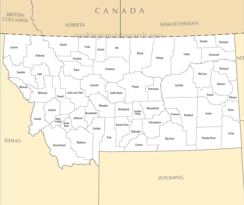
from the National Atlas of the United States
United States Department of the Interior
Montana State Map
Map search is available for a limited number of queries per session to manage costs. Be specific — search precisely for best results.
| State | Montana |
| Capital | Helena |
| Country | United States of America |
| Counties | 56 |
| Latitude | 46.921925 |
| Longitude | -110.454353 |
| Cities & Towns | 488 |
| State Map | Montana Maps |
About Montana
Montana divides itself along a jagged meridian, where the serrated limestone spines of the Rockies abruptly surrender to the vast, muscular flatness of the high plains. In the west, the landscape is defined by verticality and the cold, glacial melt of rivers that carve deep, shadowed canyons into the earth, their waters running with the clarity of hammered glass. To the east, the geography flattens into an immense prairie sea, where the horizon exerts a physical pressure on the traveler, pushing the sky into a wide, vaulted dome that seems to hold more light than the earth below. The air here carries a distinct, sharp metallic edge, particularly in the autumn when the heat of the day dissipates into a sudden, biting frost that turns the sagebrush a bruised shade of silver.
Indigenous nations—the Blackfeet, Crow, Salish, and others—held these river valleys and hunting grounds for generations before the arrival of explorers and the subsequent, violent collision of cultures that defined the nineteenth century. The narrative of Montana is written in the debris of this expansion: the abandoned mining camps, the rusted tracks of transcontinental railroads, and the treaties that were signed only to be broken by the hunger for gold and grazing land. Statehood arrived as an afterthought to the frantic extraction of copper and silver, transforming a wild frontier into a political entity shaped by the conflicting impulses of rugged individualism and the cold, mechanical efficiency of corporate mining interests. The ghosts of this era remain, lingering in the weathered timber of homestead cabins that lean into the wind, waiting for the prairie grass to eventually reclaim their foundations.
Economic life in Montana has always been a negotiation with the constraints of distance and climate, alternating between the cycles of dryland wheat farming and the heavy, industrial labor of the mines. Ranching remains the primary pulse of the rural interior, requiring a stoic endurance against winters that can turn iron brittle and silence the land for months on end. While the shift toward a service-oriented economy has introduced new pressures, the state continues to draw its identity from the tangible production of commodities—timber, grain, and mineral wealth—that bind the population to the seasons. A grain elevator standing against a bruised, violet dusk is not merely a structure but a sentinel, marking the slow, deliberate work of a people who have learned to measure their prosperity by the weight of a harvest or the health of a calf crop.
Cultural expression in Montana finds its cadence in the quiet spaces between the noise of modern life, favoring a reserve that mirrors the immense, open geography. Literature and music here often grapple with the tension between the myth of the solitary frontiersman and the reality of small, tight-knit communities where everyone is tethered to the same social gravity. Collegiate sports provide a necessary, seasonal friction, drawing thousands into stadiums that feel oddly exposed against the backdrop of the mountains, yet the pace of life remains tethered to the sun and the unpredictable mood of the weather. There is a particular, unforced dignity in the way a rancher or a fly-fisherman moves through the day—a deliberate, measured energy that acknowledges the indifference of the wild landscape while insisting on the necessity of human connection.
Montana Cities and Towns by County
Big Horn County
Blaine County
Cascade County
Chouteau County
Flathead County
Glacier County
Hill County
Jefferson County
Judith Basin County
Lake County
Lincoln County
Madison County
Missoula County
Park County
Phillips County
Ravalli County
Sanders County
Teton County
Yellowstone County
Montana County Maps & Location Information
This page provides an interactive Google map of Montana (MT) with Street View, satellite and terrain views, alongside links to detailed street maps for all 488 cities and towns across the state organised by county. Montana has 56 counties, with the state capital at Helena.
Every locality page includes an embedded street and satellite map alongside live weather where available — combining National Weather Service forecasts with Open-Meteo graphical data including hourly observations and 7-day outlooks. Local and world news feeds, Wikipedia summaries and editorially written descriptions are included where available.
Location data is sourced from the USGS GNIS database and the SimpleMaps US Cities dataset, verified by coordinates rather than name matching alone.
