A large detailed map of Wyoming State
This is a large, detailed map of Wyoming. There are links to many Wyoming localities below. Our website format reduces the display size for uniformity. Here is a link to the full-size image that is more easily readable.
View our Wyoming State county map
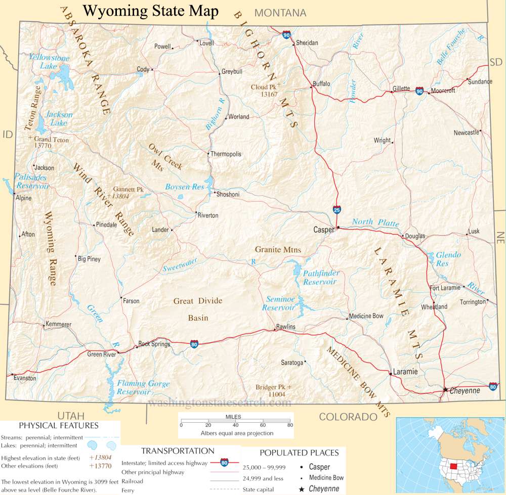
from the National Atlas of the United States
United States Department of the Interior
Wyoming State Map
Explore Wyoming with an interactive map featuring Street View, satellite and terrain views. Live weather, local news and location details for Wyoming — plus links to detailed street maps for 201 cities and towns across the state.
Map search is available for a limited number of queries per session to manage costs. Be specific — search precisely for best results.
| State | Wyoming (WY) |
| Capital | Cheyenne |
| Largest City | Cheyenne |
| Country | United States |
| Latitude | 42.755966 |
| Longitude | -107.30249 |
| Population | 576,851 |
| Cities & Towns | 201 |
Wyoming presents a landscape of stark, high-altitude contrasts, where the earth seems to exhale a primordial heat through the volcanic vents and geysers of the northwest. To the west, the jagged, granite teeth of the Wind River Range and the vertical audacity of the Tetons rise abruptly from the basin floor, catching the first light of dawn in a bruised, violet glow that makes the surrounding sagebrush appear silvered and ancient. This topography is defined by the continental divide, a spine that dictates the path of rivers like the Bighorn and the Snake as they carve through sedimentary rock and arid plateaus. Eastward, the terrain softens into the expansive, wind-scoured plains, where the horizon stretches so thin it threatens to dissolve the distinction between the pale, dry earth and the immense, shifting sky.
Indigenous nations—the Shoshone, Arapaho, Crow, and Lakota—maintained a profound intimacy with these corridors long before the arrival of trappers and the lumbering wagon trains that sought passage toward the Pacific. The arrival of European settlers signaled a shift from nomadic fluidity to the rigid demarcations of the frontier, as military outposts and cattle trails began to scar the grasslands. Wyoming achieved statehood in the final decade of the nineteenth century, a period defined by the violent friction between open-range ranchers and homesteaders, as well as the abrupt transformation of the wilderness into a managed territory. This history remains visible in the bleached wood of abandoned homesteads, standing as skeletal reminders of those who pitted their endurance against a climate that rarely offered mercy to the unprepared.
Mineral wealth and the labor of the earth have long dictated the pulse of the local economy, with the state serving as a primary provider of coal, trona, and energy resources that fuel the nation’s industrial appetite. Agriculture remains a foundational thread, though it is a pursuit of hardscrabble resilience; ranchers manage vast expanses of scrubland where cattle graze on sparse, hardy grasses, moving with the seasonal shifts of the wind. The air here carries a distinct, dry fragrance of crushed juniper and cold dust, a scent that seems to permeate the work clothes of those who labor in the extraction industries or manage the irrigation systems that sustain the hay meadows. It is an economy of extraction and endurance, where the prosperity of the state fluctuates in tandem with the global demand for the raw materials pulled from its deep, rocky strata.
Wyoming fosters a culture that prioritizes self-reliance and a quiet, deliberate pace, where the social life often centers on the endurance of the rodeo circuit or the localized solidarity of the collegiate sports arena. Literature from this region, often stark and unvarnished, reflects a landscape where silence is a physical presence, shaping the way people speak—measured, direct, and rarely prone to unnecessary embellishment. At dusk, when the wind finally settles and the shadows of the mountains lengthen across the valley floors, the towns take on a somber, solitary beauty, with porch lights flickering like distant stars against the vast, darkening expanse. The people here possess a pragmatic stoicism, a recognition that to live in such a space is to accept a life lived in the company of immense, indifferent forces, finding a quiet satisfaction in the simple, repetitive labor of maintaining a home in a country that is as unforgiving as it is beautiful.
Wyoming City and Town Maps
A
B
C
E
F
H
J
L
M
P
R
S
T
V
W
Wyoming Maps — Interactive Map, Street View, Weather & News
This page provides an interactive Google map of Wyoming (WY) with Street View, satellite and terrain views, alongside links to detailed street maps for 201 cities and towns across the state. The state capital is Cheyenne and the largest city is Cheyenne, with a state population of approximately 576,851.
Each city and town map page includes an embedded street and satellite map. Live weather where available combines National Weather Service forecasts with Open-Meteo graphical data including hourly and 7-day outlooks. Local and world news, Wikipedia location summaries, and precise GPS coordinates are included where available.
Location data is sourced from the USGS GNIS database and verified by coordinates, not name matching alone.
