New York City Map
Home > New York Maps > New York City Maps
Welcome to our New York City Map Page
The street map of New York City that is located below is provided by Google Maps. You can "grab" the New York City street map and move it around to re-centre the map. You can change between standard map view and satellite map view. You can also use the zoom bar to zoom in or out. You can use the search form above to search for any location in the world.
This is a huge map. Our webpage page format is mobile responsive. Your browser will therefore reduce the size of the map so that it fits on your screen.
Here is a link to the full size image intended for desktop viewing (Tip: don't click the link using your smartphone).
Hello. I hope you like the New York City, NY, USA street map.
If you like our website, please consider adding a link to the site. Backlinks help to build website traffic and they are considered a vote of confidence for a site.
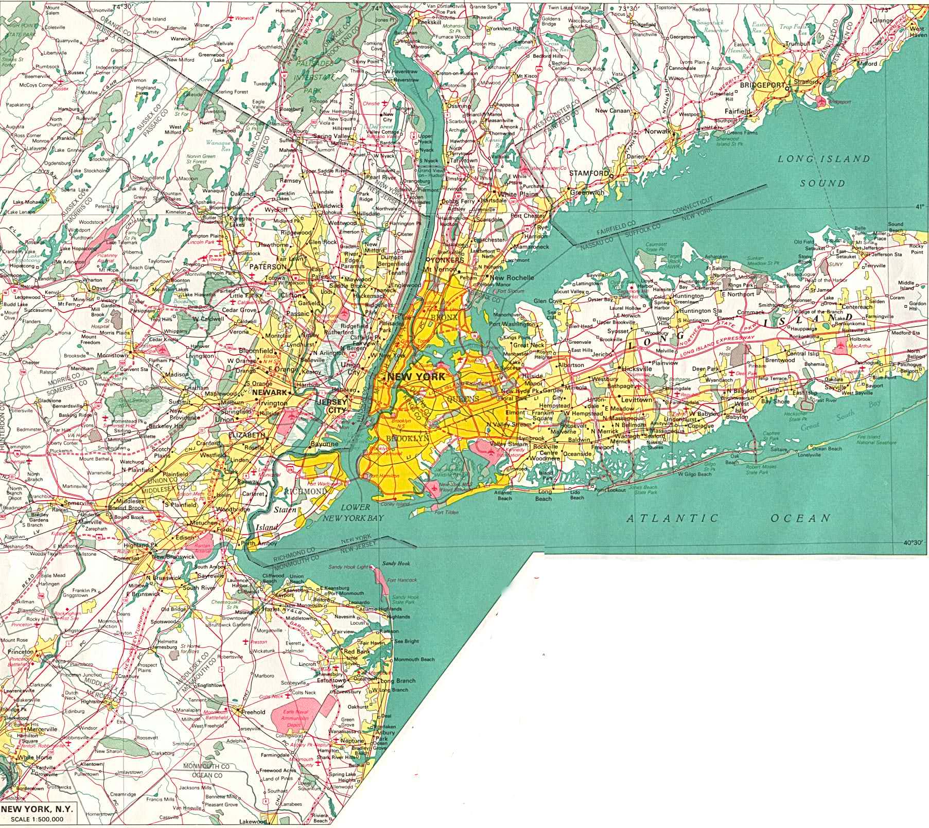
The map below is a large detailed street map of New York City. It dates from the 1970's so it is somewhat dated but it still contains lots of useful information.