Map of the Columbia River basin
with dams highlighted
Home Page > Washington State Maps > Map of the Columbia River basin with dams highlighted
The Columbia River carved the Interior Columbia River Basin from the landscape of seven Western states and two Canadian provinces. The river itself flows from its headwaters in British Columbia, Canada through only two states, forming part of the Washington-Oregon border, the vast Interior Columbia River Basin is defined by the area drained by the river and its many tributaries. This 58-million-hectare area (about the size of France) extends roughly from the crest of the Cascade Mountains of Oregon and Washington east through Idaho to the Continental Divide in the Rocky Mountains of Montana and Wyoming, and from the headwaters of the Columbia River in Canada to the high desert of northern Nevada and northwestern Utah.
Columbia River Basin Map
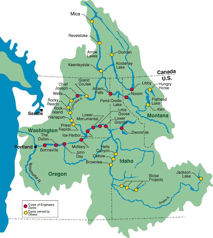
U.S. Army Corps of Engineers, North Pacific Region